Roads of Mauritius
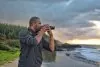
Browse road photos from Mauritius, including coastal roads, village streets, mountain routes, sugarcane field roads, highways, bridges, scenic drives and everyday island journeys captured by Explora photographers.
Read more about roads in Mauritius
About Roads of Mauritius
Roads in Mauritius are more than a way to move from one beach to another. They are part of the island’s landscape: coastal roads beside turquoise lagoons, narrow village streets, mountain roads through forest, straight roads through sugarcane fields, busy highways near Port Louis and quiet tracks leading to waterfalls, viewpoints or small coastal corners.
For visitors and photographers, the roads of Mauritius help explain the island. A road can show how villages connect to beaches, how sugarcane fields stretch towards mountains, how the coast changes from calm lagoon to wild cliffs, and how modern infrastructure sits beside older rural scenery. Not always glamorous, perhaps. But very real.
The Road Network in Mauritius
Mauritius has a dense road network for a small island. The main classified roads include motorways, main roads and secondary routes that connect the capital, towns, villages, beaches, hotels, industrial areas, agricultural land and tourist attractions.
The road network includes major motorways such as the M1, M2 and M3, as well as many A and B roads. These routes allow visitors to move between Port Louis, the airport, Grand Bay, Curepipe, Quatre Bornes, Rose Hill, Mahebourg, Flic en Flac, Black River, Flacq, Bel Ombre and many other parts of the island.
Main Motorways in Mauritius
The M1 is one of the most important roads in Mauritius. It connects Port Louis with the central towns and continues towards the south-east and the airport region. It is the road many visitors use shortly after arriving on the island.
The M2 connects Port Louis with the north, including the direction of Pamplemousses, Triolet, Grand Bay and other northern coastal areas. It is one of the main routes for people travelling between the capital and the north coast.
The M3, also known through the Terre Rouge, Verdun and Trianon link, is important because it helps bypass some of the heavy traffic around Port Louis and connects key central and northern routes. It has changed the way many people move across the island, especially between the north and the central plateau.
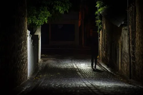
Roads Through Villages and Towns
Some of the most interesting roads in Mauritius are not the fastest ones. They are the roads through villages and towns, where everyday life happens close to the street.
You may see shops, temples, churches, schools, markets, buses, fruit stalls, bicycles, dogs, pedestrians, roadside snacks and small houses almost touching the road. These streets can be busy, narrow and unpredictable, but they are also full of visual detail.
For photography, village roads can show the living side of Mauritius better than a perfect empty landscape. A road in Mahebourg, Souillac, Grand Gaube, Chamarel or Bel Ombre can tell a whole story if you frame it properly.
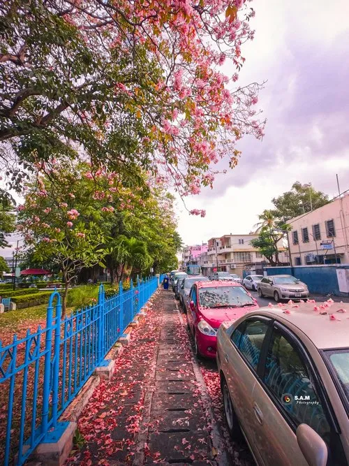
Coastal Roads in Mauritius
Coastal roads are among the most scenic routes in Mauritius. They follow beaches, lagoons, fishing villages, rocky shores, hotel zones, public beaches and quiet sea views. Some are flat and relaxed, while others twist between cliffs, mountains and ocean.
Beautiful coastal roads can be found around Flic en Flac, Tamarin, Black River, Le Morne, Baie du Cap, Bel Ombre, Gris Gris, Blue Bay, Mahebourg, Belle Mare, Poste Lafayette, Grand Gaube and Cap Malheureux.
These roads are especially good for travel photography because they connect several visual elements in one image: sea, road, people, trees, boats, villages and sometimes mountains in the background.
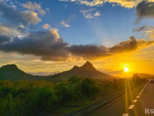
The Macondé Coastal Road
The Macondé coastal road between Baie du Cap and Le Morne is one of the most famous scenic drives in Mauritius. It runs along the south-west coast, with mountains on one side and the sea on the other.
The viewpoint at Macondé is especially popular for photos. From there, the road curves along the coast, the lagoon opens below, and the south-west landscape feels dramatic and wide. It is one of the best examples of a Mauritian road becoming a photo subject in itself.
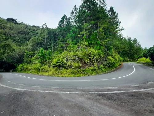
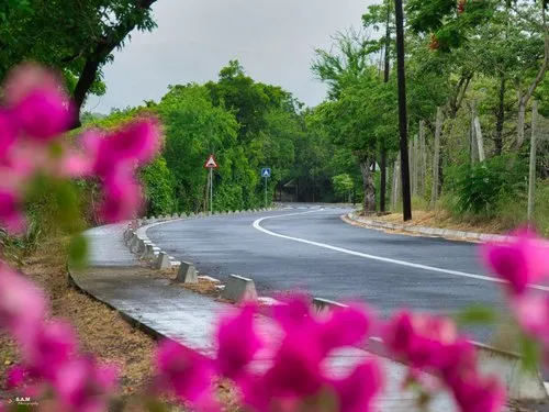
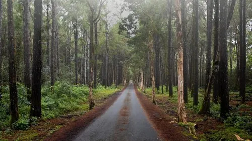
Mountain Roads
Mountain roads in Mauritius offer some of the most atmospheric inland views. Around Chamarel, Plaine Champagne, Grand Bassin, Black River Gorges, Le Morne, Moka and the central plateau, roads climb, bend and pass through cooler, greener landscapes.
These roads often connect with mountain views, forest areas, waterfalls and viewpoints. They can be narrow, misty or slippery after rain, but they reveal a side of Mauritius that beach-only visitors may miss.
For photographers, mountain roads work well when they include curves, mist, forest, distant valleys or a vehicle giving scale to the landscape. A road disappearing into trees can be more powerful than a wide open beach scene if the mood is right.
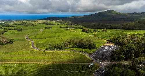
Roads Through Sugarcane Fields
Sugarcane field roads are classic Mauritian scenes. Across many rural areas, roads cut through long green fields, with mountains, villages, old chimneys or clouds in the distance.
These roads are strongly linked to sugarcane and the agricultural history of Mauritius. From the ground, they feel simple and peaceful. From above, they become lines and patterns, especially in drone photography.
During harvest season, sugarcane roads become busier with tractors, trucks and workers. This adds movement and texture to the landscape, but also means drivers should be careful and patient.
Forest Roads and Nature Routes
Some roads in Mauritius pass through or beside forests and nature parks. Around Black River Gorges, Bras d’Eau, Chamarel, Grand Bassin, Daruty Forest and the highlands, roads become part of the green inland scenery.
These routes are good for nature photography because they combine trees, shadows, mist, birds, monkeys, mountain light and quiet road curves. Early morning is especially good, when the air is cooler and the forest still feels undisturbed.
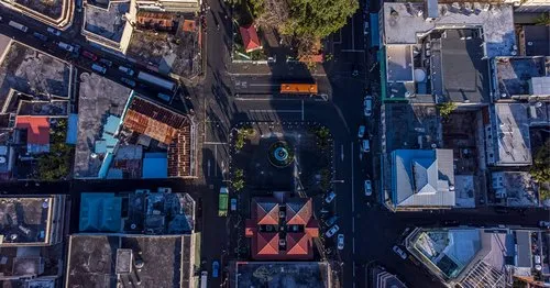
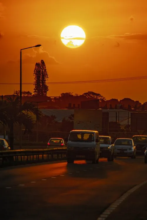
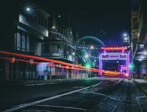
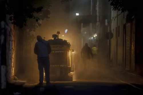
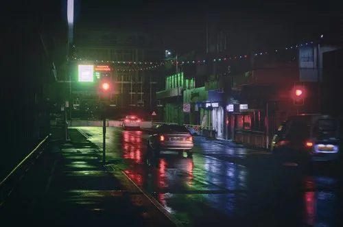
City Roads and Urban Traffic
Roads in Port Louis, Rose Hill, Quatre Bornes, Curepipe, Vacoas, Beau Bassin and other urban areas show another side of Mauritius. This is the island of traffic, buses, offices, shops, signs, pedestrians, roundabouts, traffic lights, street vendors and daily commuting.
Port Louis is especially interesting for urban road photography because of the contrast between old buildings, modern offices, market streets, harbour roads and busy traffic. It is not always easy to photograph, but it is full of life.
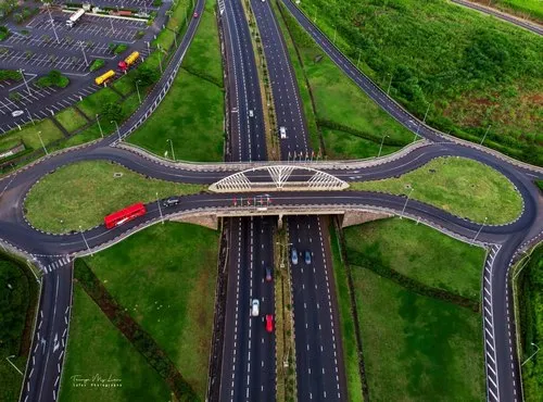
Roundabouts and Interchanges
Roundabouts are very common in Mauritius. They help traffic move between towns, motorways, shopping areas and village roads, and they are part of the driving experience on the island.
Large interchanges and flyovers, such as those around Ebène, Trianon, Phoenix, Terre Rouge, Verdun and Port Louis, show the more modern side of the road network. They are useful for traffic flow, but also interesting visually, especially from above.
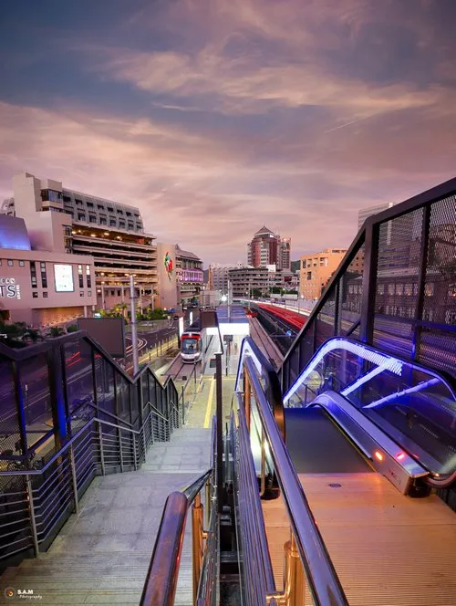
Ebène Interchange and Modern Road Infrastructure
The Ebène and Trianon areas show how road infrastructure has changed with the growth of business districts, shopping centres and central urban development. Flyovers, slip roads and interchanges help manage traffic between the central plateau, Moka, Port Louis and other busy zones.
For photography, these areas are more urban and graphic than scenic. Roads, lanes, lights, office buildings and traffic movement can create strong modern island images, especially at night or from elevated viewpoints.
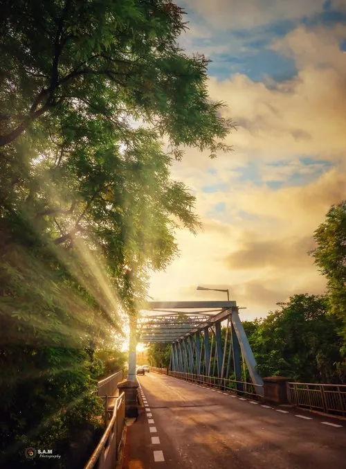
Roads, Bridges and Rivers
Roads in Mauritius often cross rivers, ravines and small watercourses. Bridges are part of the island’s road identity, especially in rural areas, old villages, mountain routes and coastal roads.
Bridges can make road photos more interesting because they add structure, height and history. A road crossing a river, a stone bridge in a village or a bridge surrounded by forest can show how the island’s geography shapes movement.
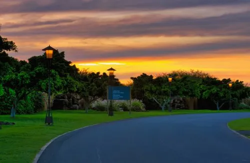
Roads to Beaches and Hotels
Many visitors experience Mauritius through the roads leading to beaches, hotels and coastal villages. Some of these roads are wide and modern. Others are narrow, shaded, sandy, busy or lined with small shops and parked cars.
Roads around Grand Bay, Trou aux Biches, Flic en Flac, Belle Mare, Blue Bay, Le Morne and Bel Ombre are especially connected with tourism. They lead to beach access points, resorts, restaurants, public beach parking, boat departures and coastal attractions.
Scenic Roads to Photograph in Mauritius
Some of the most photogenic roads in Mauritius include the Macondé coastal road near Baie du Cap, the road to Chamarel, the road through Black River Gorges and Plaine Champagne, the coastal road around Le Morne, the sugarcane roads of Bel Ombre and Médine, the Blue Bay to Mahebourg coastal road, the road around Grand Gaube and Calodyne, the road to Grand Bassin, and the roads through Bras d’Eau and Daruty Forest.
This is not a complete road map. It is a photography-oriented list of routes that often show the beauty, variety and character of Mauritius.
Driving in Mauritius
Driving in Mauritius is on the left-hand side of the road. For visitors from countries where people drive on the right, this can take some adjustment, especially at roundabouts, junctions and narrow village roads.
The main motorways are generally easier to drive than small rural roads. In villages and towns, drivers need to watch for pedestrians, buses, cyclists, scooters, dogs, parked cars, sudden stops and people crossing where you did not expect them. In other words, stay awake.
Road Safety in Mauritius
Road safety is an important issue in Mauritius. Drivers should respect speed limits, avoid drink-driving, use seatbelts, keep distance, be careful at pedestrian crossings and remain patient in traffic.
Rural roads can be narrow, and some scenic routes have sharp bends, poor visibility, wet surfaces or steep drops. Coastal roads can also be distracting because the view is beautiful. Beautiful views are not a licence to forget the road.
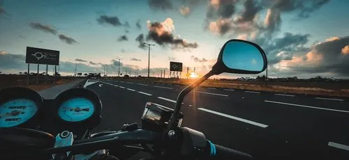
Road Trips Around Mauritius
Mauritius is a good island for road trips because distances are relatively short, yet the scenery changes quickly. In one day, you can pass from city roads to sugarcane fields, mountain routes, forest trails, coastal villages and beaches.
A west and south-west road trip might include Flic en Flac, Tamarin, Black River, Chamarel, Le Morne, Macondé and Bel Ombre. A south-east road trip might include Mahebourg, Blue Bay, Pointe d’Esny and Ferney. A northern road trip could include Grand Bay, Cap Malheureux, Grand Gaube, Calodyne and Pamplemousses.
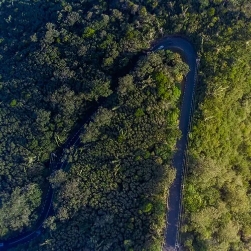
Drone and Aerial Road Photography
Drone and aerial photography can make roads in Mauritius look especially striking. From above, roads become lines through sugarcane fields, curves along the coast, routes between villages, or patterns around roundabouts and interchanges.
Aerial views are especially strong where roads meet landscapes: coastal roads beside lagoons, mountain roads through forest, bridges over rivers, roads crossing sugarcane fields and city roads glowing at night.
Photography Tips for Roads in Mauritius
Road photography works best when the road leads the eye somewhere. Look for curves, straight lines, shadows, vehicles, mountains, trees, bridges, village buildings, sugarcane rows or the sea at the end of the frame.
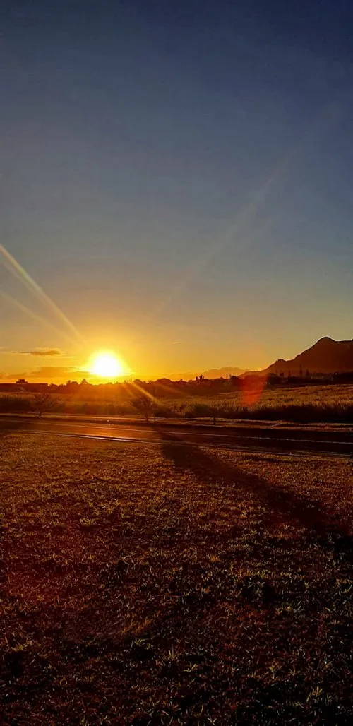
Early morning is good for quiet roads and soft light. Late afternoon gives warmer tones and longer shadows. Cloudy weather can also work well, especially for mountain roads, forest roads and old village streets.
If you are photographing from the roadside, choose safe places to stop. Do not stand in traffic, block a lane, stop on blind corners or step into the road for a better angle. No photo of a road is worth becoming part of the traffic report.
Roads and Everyday Mauritius
The roads of Mauritius show everyday life better than many tourist attractions. Buses full of commuters, students walking home, roadside fruit stalls, scooters, cane trucks, food vendors, old signs, religious buildings and village traffic all reveal how the island moves.
That is why road photos can be powerful on a photography website. They connect landscapes with people, places with movement, and scenic Mauritius with daily Mauritius.
Visiting Tips
If you plan to drive around Mauritius, allow more time than the map suggests. Traffic, roundabouts, narrow roads, roadworks, buses and parking can all slow you down, especially near Port Louis, Grand Bay, Curepipe, Quatre Bornes and popular beaches.
For scenic drives, start early, keep fuel in the car, avoid rushing, and use safe viewpoints for photos. The best road experiences in Mauritius often happen when you are not trying to reach the next stop too quickly. Slow down, where safe. The island looks better that way.
Road Photos from Mauritius
Explore photos of roads in Mauritius, from coastal drives and village streets to mountain routes, sugarcane field roads, highways, bridges, forest roads, scenic viewpoints and everyday island journeys.