Drone & Aerial Photography of Mauritius
Browse drone and aerial photos of Mauritius, including beaches, lagoons, villages, forests, towns at night, sugarcane fields, coastal roads and island landscapes captured from above by Explora photographers.
Read more about drone and aerial photography in Mauritius
About Drone and Aerial Photography of Mauritius
Drone and aerial photography show Mauritius from a completely different angle. From the ground, the island is already beautiful enough, yes. But from above, the shapes suddenly become clearer: lagoons turn into blue patterns, roads cut through sugarcane fields, villages sit between mountains and coast, and beaches reveal their full curve instead of just one small view from the sand.
This is why aerial photos are so useful on Explora. They help visitors understand the geography of Mauritius, not only the scenery. A beach becomes part of a lagoon. A village becomes part of a coastline. A forest becomes part of a mountain range. Everything connects better from the air.
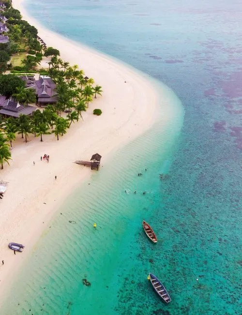
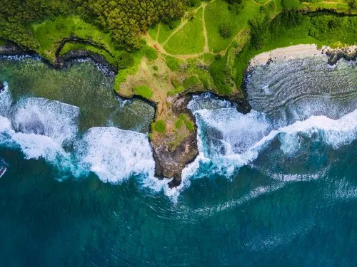
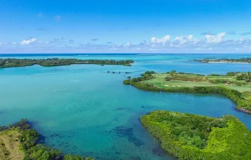
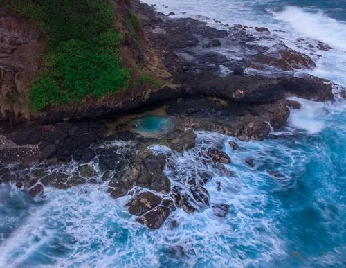
Aerial Views of Beaches and Lagoons
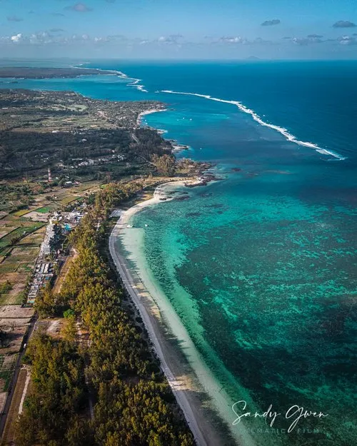
Some of the most striking drone photos in Mauritius are taken above beaches and lagoons. From above, the water colours are easier to read: pale turquoise near the shore, darker blue near reef channels, sandy patches, coral areas, boats, swimmers and the line where the lagoon meets the open ocean.
Places such as Le Morne, Belle Mare, Blue Bay, Trou aux Biches, Mont Choisy and Flic en Flac can look very different from the air. The beach is still there, of course, but the aerial view adds scale. It shows the reef, the village behind, the roads, the hotels, the boats, the trees. The bigger picture, literally.
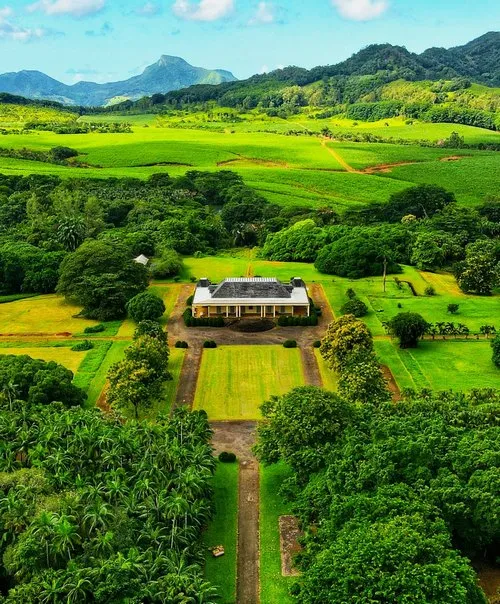
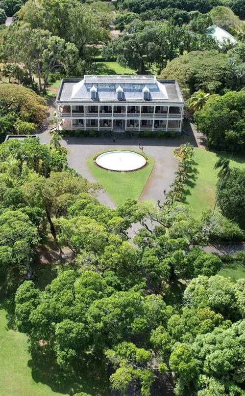
Villages, Towns and Local Life from Above
Aerial photography is also interesting for villages and towns in Mauritius. From above, you see how settlements are shaped: houses close to the coast, roads running inland, football grounds, churches, temples, markets, schools, rooftops, small gardens and the everyday layout of Mauritian life.
This kind of view is useful because it shows Mauritius beyond the postcard. Not only beach, hotel, lagoon, done. You can see how people live around those landscapes. A coastal village from above may show fishing boats, beach access, narrow streets and local houses all in one frame. Much more honest, sometimes.
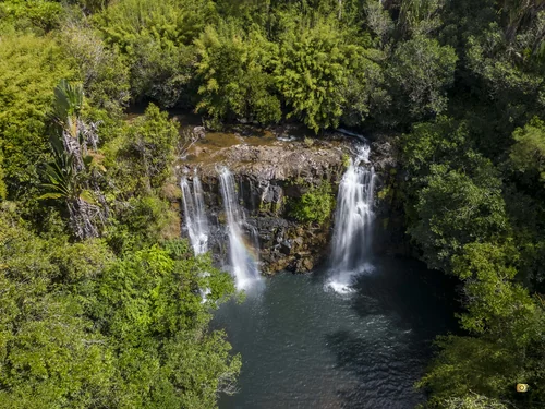
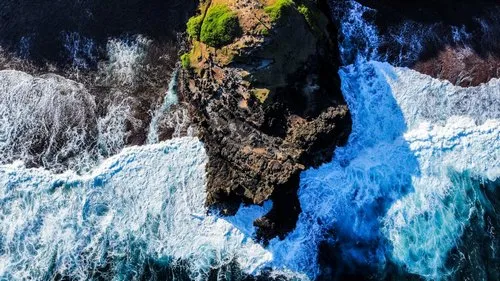
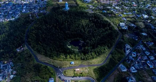
Aerial Views of Forests and Mountains
Drone photos can also reveal the inland character of Mauritius. The island has more than beaches. It has forest and nature areas, mountains, valleys, waterfalls, reservoirs and steep green slopes that are not always easy to appreciate from the road.
Places around Chamarel, Black River Gorges, 7 Cascades, Le Morne and the central highlands often look stronger from above because the aerial view shows the shape of the land. Forest edges, ridgelines, ravines, mountain shadows and winding roads become part of the composition.
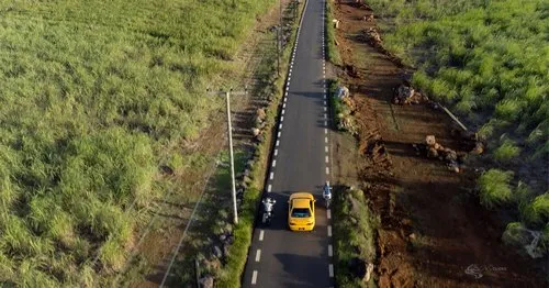
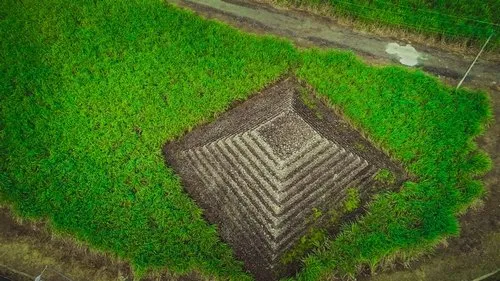
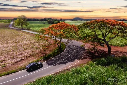
Sugarcane Fields from the Air
Sugarcane fields are one of the classic aerial subjects in Mauritius. From ground level, they may look like simple green fields. From above, they become patterns: straight lines, curves, tracks, tractors, harvest marks, patches of different green and brown, and roads cutting through the land.
Sugarcane has shaped Mauritius for centuries, so aerial photos of cane fields are not just pretty geometry. They also show a part of the island’s agricultural history and landscape identity. A drone photo of a road between cane fields can say a lot with very little.
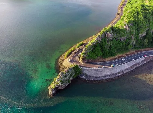
Roads, Curves and Coastal Drives
Aerial views of roads can be surprisingly beautiful. A coastal road near the sea, a mountain road turning through forest, or a straight road through sugarcane fields can make a strong composition from above.
Macondé, Chamarel roads, south coast drives, village roads and forest routes can all become interesting when seen from the sky. The road gives the viewer a line to follow. And in photography, a good line is gold.
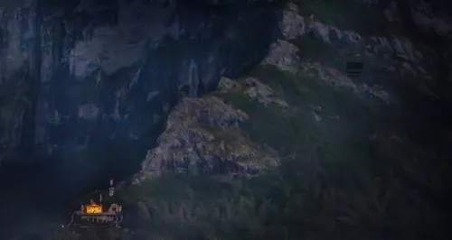
Towns at Night from Above
Drone and aerial photos of towns at night show another Mauritius altogether. Instead of lagoon colours and beaches, you get streetlights, buildings, traffic lines, harbour lights, shops, football grounds and residential areas glowing after sunset.
Night aerial photography can work well around places such as Port Louis, Grand Bay, coastal villages and inland towns. It gives a more urban, modern and slightly unexpected view of the island. Mauritius does not disappear when the sun goes down. It just changes mood.
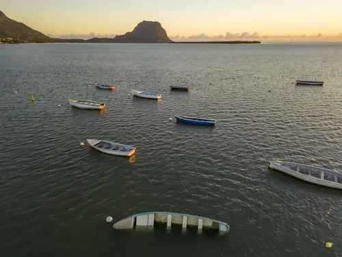
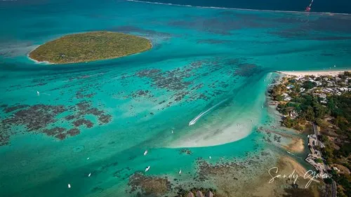
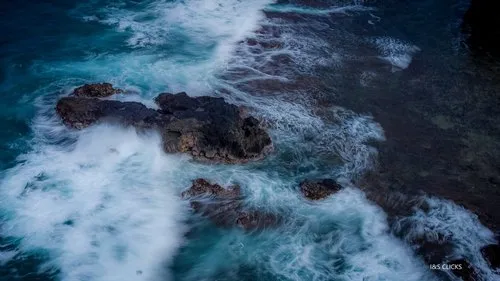
Boats, Reefs and Coastal Patterns
From above, boats become part of the landscape. Small fishing boats, catamarans, pirogues, speedboats and yachts all create scale in the lagoon. They show how wide the water is, how shallow some areas are, and how people use the coast.
Reefs and sandbanks are also much clearer from the air. You can see channels, reef edges, coral patches and the way waves break further out. This is one reason aerial photos of Mauritius often feel almost map-like. Beautiful, but also informative.
The Underwater Waterfall View
Drone and aerial-style photography is also closely linked to the famous underwater waterfall illusion near Le Morne. It is not a real waterfall, but from above, the sand and underwater slope create the impression of water falling into a deep blue drop.
This view has become one of the most recognised images of Mauritius. Still, aerial photography should not be limited to that one famous scene. The whole island has patterns worth seeing from above: farms, rivers, beaches, towns, mountains, roads and reefs. Plenty to work with.
Responsible Drone Photography
Drone photography is powerful, but it should be done responsibly. Photographers should respect local rules, avoid flying near restricted areas, airports, private property, crowds, wildlife and sensitive natural places. Not every beautiful view is worth disturbing people or nature for.
It is also important to avoid misleading photos. Extreme editing, fake colours or exaggerated effects can make Mauritius look artificial. Aerial views are already impressive enough. No need to turn the lagoon into neon paint.
Photography Tips for Aerial Mauritius Photos
Good aerial photos often depend on light, timing and simplicity. Early morning can give softer shadows and quieter beaches. Midday can bring stronger lagoon colours, especially over shallow water. Late afternoon adds warmth and longer shadows across villages, roads and fields.
Composition matters too. Look for patterns, lines, curves, contrast and scale. A tiny boat in a big lagoon. A road through cane fields. A village between mountain and sea. A line of trees along a beach. From above, Mauritius has plenty of these small visual surprises.
Visiting Tips for Aerial Photo Locations
If you are planning drone or aerial photography in Mauritius, research the location before going. Check access, weather, wind, flight restrictions and safety. Coastal wind can change quickly, especially around the east and south coasts.
For visitors who are not flying drones themselves, helicopter and seaplane tours may offer aerial views of selected areas, depending on operators and weather. Either way, seeing Mauritius from above gives a different understanding of the island. Suddenly it is not just a beach destination. It is a whole landscape stitched together by water, roads, villages and light.
Drone and Aerial Photos of Mauritius
Explore drone and aerial photos of Mauritius, from beaches and lagoons to villages, forests, towns at night, sugarcane fields, roads, boats and island landscapes seen from above.